Intelligent Transportation

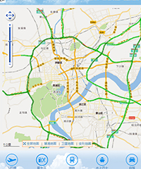
It can realize the integration of road traffic information, provide one map of the road industry, and build personalized customized location platform basing on different customer needs. At present, it has provided enterprise-level location intelligent solutions for government and enterprise units.

Highway and Waterway Geographic Information System-BIM+GIS Application

Highway and Waterway Geographic Information System-BIM+GIS Application


    Customer demand:In the design stage, we should deepen the application of BIM+GIS in collaborative design, scheme comparison and simulation evaluation. In the construction stage, we should deepen the application of BIM+GIS in delivery, virtual construction, construction organization and quality management. In the operation & maintenance stage, we should build the BIM+GIS visualization platform, and rely on the BIM database in the early stage of construction, to strengthen the application in maintenance, operation, monitoring and emergency management. 


    Solution: Full-space expression of 3D spatial model and multi-source 3D data fusion technology combined with the new WebGL vectorization rendering technology can provide 2D and 3D integrated GIS platform, to achieve high-performance BIM+GIS application scenarios rendering.


    Realization of value: Realize the monolithic application of key infrastructure in the field of highway and waterway to the full-space expression and full life cycle management. Realize the collaboration among participants in key infrastructure in the field of highway and waterway and Internet-based business management. 


Zhejiang Communications -Geographic Information Platform

Zhejiang Communications -Geographic Information Platform


    Customer Demand: Build a complete framework of LBS for China Mobile. The existing map platform on WEB can not meet the current business needs. Zhejiang Transportation Department plans to further improve and upgrade the map platform. Based on the continuous development and application of GIS map business system, it realizes the vectorization of map data, personalized map needs, integrated display of two-dimensional and three-dimensional maps. Unified and open API interface, large data platform visualization display, large data analysis system operating environment, analysis platform results directly displayed in the visualization platform and other functions. The client solution improves the quality of service of China Mobile; WEB GIS solution provides basic support for 12585 travel service application, vehicle service industry application, family relationship and map service, etc.


    Solutions: Vector map data, real-time traffic information display, basic map operation and services are provided based on MineMap platform; workbench is provided for personalized map style configuration, while providing LBS location application services such as POI search, path planning, forward and backward geocoding, as well as rich APIs and code sample templates; large data computing and analysis environment is provided for easy use. Households carry out algorithm selection, data analysis and visual display of different business topics.


    Implementing Value: Build a complete basic geographic information service platform and large data analysis system operating environment, provide large data visualization platform services; realize the integration of basic data sharing and geographic information platform, provide large data calculation and analysis and visualization services, and provide better data and platform support services for provincial, municipal and county-level traffic service geographic information system. For each business system has played a escort role.

Learn how we can help

Contact Us